|
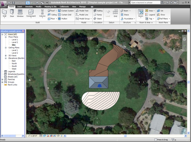
Here is a little tutorial on using visibility settings for topography and subregions, in order to use aerial maps with your Revit site plans. Here is the Screencast version.
1 Comment
|
About the AuthorGiovanni Succi is a project designer living and working in San Francisco. He is a LEED AP, and for the last twenty years he has been researching the field of computer graphics, 3D modeling, rendering, and architectural design. More Revit BlogsRevit blog (By David Light) Useful LinksAutodesk Labs Posts Keywords
All
Archives
December 2020
|
